


.gif)

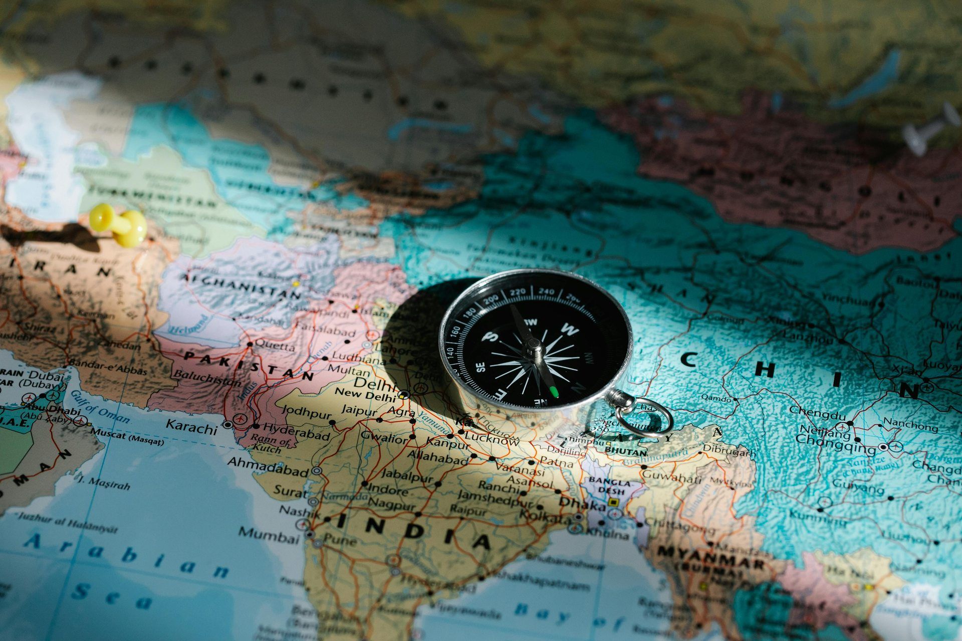
Pakistan, a South Asian country, boasts a diverse geography encompassing towering mountains, fertile plains, vast deserts, and a long coastline. The country's strategic location connects South Asia, Central Asia, and the Middle East, making it a region of great geopolitical importance.
Pakistan is home to some of the world’s most dramatic landscapes, from the snow-capped peaks of the north to the arid plains of the south. Its land supports a rich variety of flora and fauna, and its rivers provide vital water resources for agriculture and industry. Understanding Pakistan’s geography is essential to appreciating its natural wealth and environmental challenges.

1. Geographic Location and Borders
Geographic location and borders define the physical position of a place on the Earth's surface and its territorial limits. A country's geographic location influences its climate, natural resources, and strategic significance, while its borders separate it from neighboring nations. Borders can be natural, such as rivers, mountains, and oceans, or artificial, marked by political agreements and historical treaties. Some regions have well-defined borders, while others face disputes due to historical conflicts or cultural overlaps. Geographic positioning also affects trade, migration, and diplomatic relations, shaping the economic and political landscape of a nation.
Key Geographic Details:
-
Latitude and Longitude: 24° to 37° North, 60° to 77° East
-
Total Area: 881,913 square kilometers
-
Borders:
-
India (East): 3,323 km, marked by the Line of Control (LoC) in Kashmir
-
Afghanistan (Northwest): 2,670 km, including the volatile Durand Line
-
China (North): 523 km, connected through the Khunjerab Pass
-
Iran (West): 959 km, with cultural and trade ties
-
Arabian Sea (South): 1,046 km coastline, a vital route for trade and shipping
2. Major Landforms of Pakistan
Pakistan is home to diverse landforms, ranging from towering mountains to vast plains and coastal regions. In the north, the Himalayas, Karakoram, and Hindu Kush mountain ranges dominate the landscape, featuring some of the world's highest peaks, including K2, the second-highest mountain on Earth. The western part of the country is marked by rugged plateaus, such as the Balochistan Plateau, characterized by dry, rocky terrain. The central region consists of the fertile Indus Plain, formed by the Indus River and its tributaries, making it the agricultural heartland of Pakistan. To the east lies the Thar Desert, a vast arid expanse shared with India. The southern region features the Makran Coast and the Arabian Sea, providing Pakistan with a significant coastline that supports maritime trade and fishing industries.
a) The Northern and Western Mountains
The northern areas of Pakistan are home to some of the highest peaks in the world, including:
-
K2 (8,611m): The second-highest mountain in the world
-
Nanga Parbat (8,126m): Also known as the "Killer Mountain"
These regions are part of three major mountain ranges:
-
Himalayas (Northeast): A rich source of glacial water feeding Pakistan’s rivers.
-
Karakoram (North): Home to several glaciers, including Baltoro Glacier.
-
Hindu Kush (Northwest): Forms a natural border with Afghanistan.
Important passes in these mountains include:
-
Khyber Pass: A historical trade route and a link to Afghanistan.
-
Khunjerab Pass: The highest paved international border crossing.
b) The Indus Plain
-
The Indus River and its tributaries create one of the most fertile regions in the world.
-
The plain spans Punjab and Sindh and is essential for agriculture.
-
Major crops cultivated here include wheat, rice, sugarcane, and cotton.
-
Key cities: Lahore, Faisalabad, Multan, Hyderabad.
c) The Balochistan Plateau
-
Covers southwestern Pakistan, characterized by a rugged and dry landscape.
-
Sparse population due to its arid conditions.
-
Rich in minerals, including copper, gold, and natural gas.
-
Major features: Kharan Desert, Sulaiman Range, and Quetta Valley.
d) The Thar and Cholistan Deserts
-
Thar Desert: A hot and arid region in Sindh and southeastern Punjab.
-
Cholistan Desert: Known for its nomadic culture and camel breeding.
-
Extreme temperatures, with little rainfall and limited vegetation.
e) The Coastal Region
-
The Makran Coast in Balochistan features sandy beaches, cliffs, and bays.
-
The Indus Delta is an important ecological zone with mangrove forests.
-
Major ports: Karachi and Gwadar, vital for trade and economic development.
3. Climate of Pakistan
Pakistan has a diverse climate due to its varied geography, ranging from arid deserts to high-altitude mountains. The country experiences four distinct seasons: a hot summer from May to September, a monsoon season from July to September, a mild winter from November to February, and a transitional spring. The northern mountainous regions have a cold, alpine climate with heavy snowfall in winter, while the southern and western parts of the country have an arid or semi-arid climate with little rainfall. The central plains, including the Punjab and Sindh regions, experience extreme temperatures, with scorching summers and mild winters. The coastal areas along the Arabian Sea have a more moderate climate with high humidity. Pakistan's climate plays a crucial role in its agriculture, water availability, and overall economic activities
Seasonal Variations:
-
Winter (December - February): Cold in the north, mild in the south.
-
Spring (March - May): Pleasant temperatures, greenery.
-
Summer (June - September): Hot, monsoon rains.
-
Autumn (October - November): Moderate temperatures, dry.
Major Climatic Zones:
|
Climatic Zone |
Characteristics |
Example Locations |
|---|---|---|
|
Alpine |
Cold, snowy |
Gilgit, Skardu |
|
Humid Subtropical |
High rainfall, moderate temperatures |
Murree, Islamabad |
|
Arid/Desert |
Hot summers, cold winters |
Thar, Balochistan |
|
Coastal |
Moderate climate, humid |
Karachi, Gwadar |
4. Rivers and Water Resources
Pakistan's rivers and water resources are vital for agriculture, industry, and daily life. The country’s primary river system is the Indus River and its tributaries, including the Jhelum, Chenab, Ravi, Beas, and Sutlej, which originate from the Himalayas and flow through the plains before emptying into the Arabian Sea. The Indus River serves as the backbone of Pakistan’s irrigation system, supplying water to vast agricultural lands through an extensive network of canals and dams, such as Tarbela and Mangla. Besides rivers, Pakistan relies on underground water, lakes, and seasonal streams to meet its water needs. However, challenges like water scarcity, climate change, and inefficient usage threaten the country's water resources, making sustainable management crucial for future water security.
Major Dams and Reservoirs:
-
Tarbela Dam: The largest earth-filled dam in the world.
-
Mangla Dam: Provides hydroelectric power and irrigation.
-
Diamer-Bhasha Dam: A future energy and water security project.
5. Natural Resources
Pakistan is rich in natural resources, including minerals, energy sources, forests, and fertile land. The country has significant deposits of coal, salt, gypsum, limestone, and copper, with notable reserves of gold and natural gas, particularly in Balochistan and Sindh. Pakistan also has vast energy resources, including hydropower potential from rivers, coal reserves in Thar, and renewable sources like wind and solar energy. Its fertile plains, especially in Punjab and Sindh, support agriculture, which is the backbone of the economy, producing crops such as wheat, rice, cotton, and sugarcane. Additionally, forests in the northern and western regions provide timber, while fisheries along the Arabian Sea contribute to the livelihood of coastal communities. Proper management and sustainable use of these resources are essential for Pakistan’s economic growth and environmental conservation.
a) Mineral Wealth:
-
Coal: 175 billion tons (Thar reserves)
-
Natural Gas: Found in Balochistan, Sindh
-
Copper & Gold: Reko Diq in Balochistan
b) Agriculture:
-
Major crops: Wheat, rice, cotton.
-
Fruits: Mangoes, oranges, apples.
-
Livestock: Cattle, buffalo, poultry.
c) Biodiversity:
-
Forests cover 4.8% of Pakistan’s land.
-
Wildlife includes snow leopards, Markhor, Indus dolphins.
6. Environmental Concerns
Pakistan faces several environmental concerns, including deforestation, air and water pollution, climate change, and water scarcity. Rapid urbanization, industrialization, and deforestation have led to significant environmental degradation, affecting biodiversity and natural habitats. Air pollution, particularly in major cities like Lahore and Karachi, is a growing issue due to vehicle emissions, industrial waste, and crop burning, leading to severe health problems. Water pollution from industrial discharge and agricultural runoff threatens freshwater resources, while mismanagement of water supply contributes to shortages. Climate change has intensified extreme weather events, such as floods, droughts, and heatwaves, impacting agriculture and livelihoods. Additionally, improper waste disposal and plastic pollution harm ecosystems. Addressing these concerns through sustainable policies, reforestation efforts, and pollution control measures is crucial for Pakistan’s environmental well-being.
-
Deforestation: Unregulated logging reduces green cover.
-
Water Scarcity: Overuse of groundwater is a serious issue.
-
Air Pollution: Smog in cities like Lahore and Karachi.
-
Climate Change: Increases in floods and glacial melting.


Sign in
to continue to ilmkidunya.com